This walk effectively divides into four sections:
- A) Trooditissa Monastery to Kampi tou Kalogyrou (8km)
- B) Kampi tou Kalogyrou to Prodromos via Prodromos dam (7.5 km)
- C) Prodromos to Kampi tou Kalogyrou (5km)
- D) Kampi tou Kalogyrou to Trooditissa Monastery (3.5 km)
The following – which is the walk which we did – covers all the sections in a figure of eight, but you can put together sections A & D or sections B & C to make shorter circular walks.
Park just outside the gates of Trooditissa Monastery (which is no longer open to tourists). Walk through the wooden gates at the end of the car park, past the monastery on your left and out onto the track at the far end. After about 5 minutes you will reach a junction where there is a bench and a shelter. Continue along the track which curves around the mountain offering lovely views down to Foini.
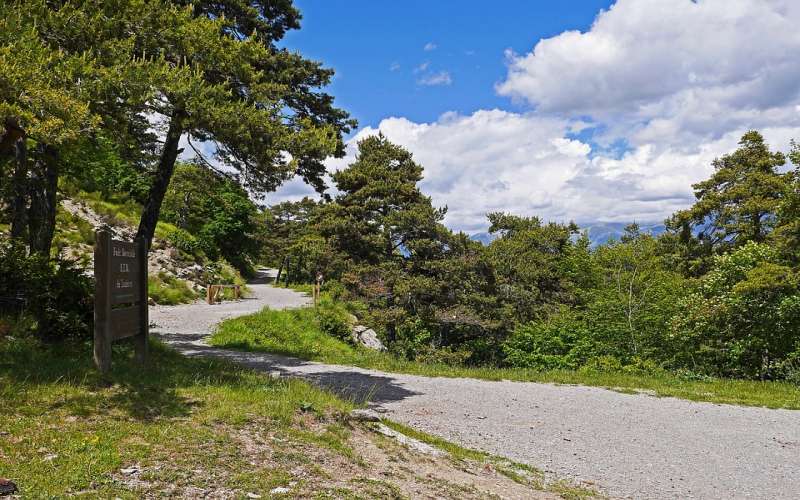
After about 20 minutes you will pass a trail off to your right – this is the return route. Ignore this for now and carry straight along the main trail, following the little walkers sign.
After 25 minutes you arrive at a three-way signpost to Foini 4km, Agios Dimitrios 7km & back to Trooditissa 2km. Follow the route towards Agios Dimitrios.
At 50 minutes you reach a clearing where there is a concrete water tank and a signpost to Agios Dimitrios 5km and to Prodromos 8km. Follow the earthen road towards Prodromos. You are now on the European Long Distance Path E4 and you will see periodic signs indicating this. The track climbs gently and at you will reach a fork in the road where a signpost indicates Palaiomylos 4km to your left. Take the right fork and walk for another 5 minutes to reach the Kampi tou Kalogyrou picnic & campsite at 1 hour 30 minutes (Toilets and water available here).
When you are ready to carry on, cross the main road (between Trooditissa and Prodromos) and follow the E4 route up the hill behind the picnic site This isn’t clearly marked. Your best bet is to start from behind the water taps from where you will see a rough track which leads uphill around the right-hand side of a large concrete water tank. This is your route.
Follow this uphill for about 7 minutes until you reach a T-junction with a wide earth track. Turn left here, leaving the E4 route. A minute or two later you pass a signpost pointing right to Asprokremmos. Keep following the trail straight ahead as indicated to ‘Prodromos Dam 4km’. About 7 or 8 minutes later you will come to a fork in the track. To continue to Prodromos reservoir, take the right hand fork heading uphill. Keep along this track as it continues to climb steadily towards the reservoir at 1400m above sea level. You will reach a junction with a signboard for the picnic site and 5 minutes later you arrive at Prodromos reservoir. After stopping for a rest at the reservoir you need to make your way to Prodromos itself. The only sure way we have found to do this is to return to the Prodromos dam picnic site signboard and turn left to climb up the hill to the road.
Turn left onto the ashphalt road, walking downhill for about 25 minutes to arrive at Prodromos. You will see a roundabout near a restaurant and a gift shop. From the roundabout there is a narrow cobbled street leading downhill behind the mini market with a yellow pillar box on the left hand side. Take this street to reach an asphalt road. Cross the road and carry straight on, passing a house with green shutters on your right. This is a concrete and cobblestone road heading steeply downhill. Follow it straight on as it leaves the village, passing water tanks with goldfish swimming in them and through vineyards and orchards. Ignore all of the tracks going off to the right or left. Most of them are very obviously not the main track so you shouldn’t lose your way here. After 20 minutes you will reach a fork in the road with a small hut directly in front of you.
Take the path to the left. 10 minutes later you will reach another fork where you take the downhill path to the right and after another 10 minutes, go left at the next fork in the path.Continue along the path to return to the Kambi tou Kalygyrou camp site. You now need to turn right onto the asphalt road and walk along it for about 10 minutes. Pass the sign indicating Platanos Kalogyrou on the left of the road. Very soon afterwards you will see a track leading off the road to the right and signposted to Trooditissa 3km.
Follow this until it rejoins the path you took when you left the monastery this morning.This is the point where the walkers signs are – see photo above at 20 minutes point. Turn left here and climb back to the monastery. Just before you reach Trooditissa you will see a huge sign saying that the road is closed. Ignore this – it means closed to vehicles. You should be back at your starting point after about 5 hours 45 minutes.
Note: these timings do not allow for any stops.
Share this article
 English
 Ελληνικά
 Русский