English
 Ελληνικά
 Русский
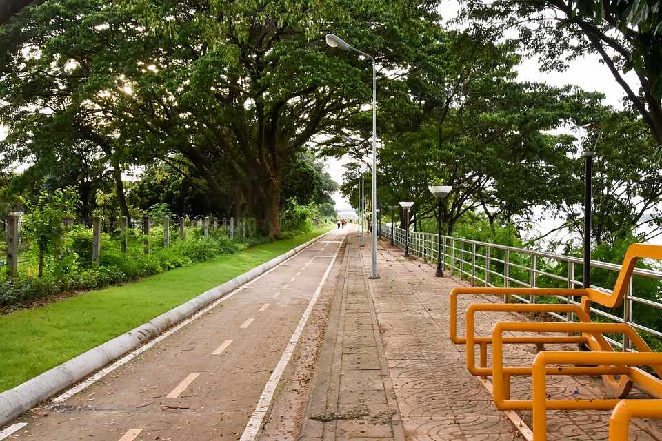
Bicycle routes - Limassol, Larnaka & Red Soil Villages
Coastal cycling routes
Cycling is a sport that can be done also on an amateur level and requires only a few things: a bike in excellent working condition, water, a spare tire, a ciclist (trying to reach, at least) in good physical shape and a road or a path to grow. And like all the sports, it's something that you learn, you never give up. Something like a cyclist I confirm. And after seeing the general cycling conditions in Cyprus, the time has come to look at various cycling routes as proposed by various competent bodies or by the writer.
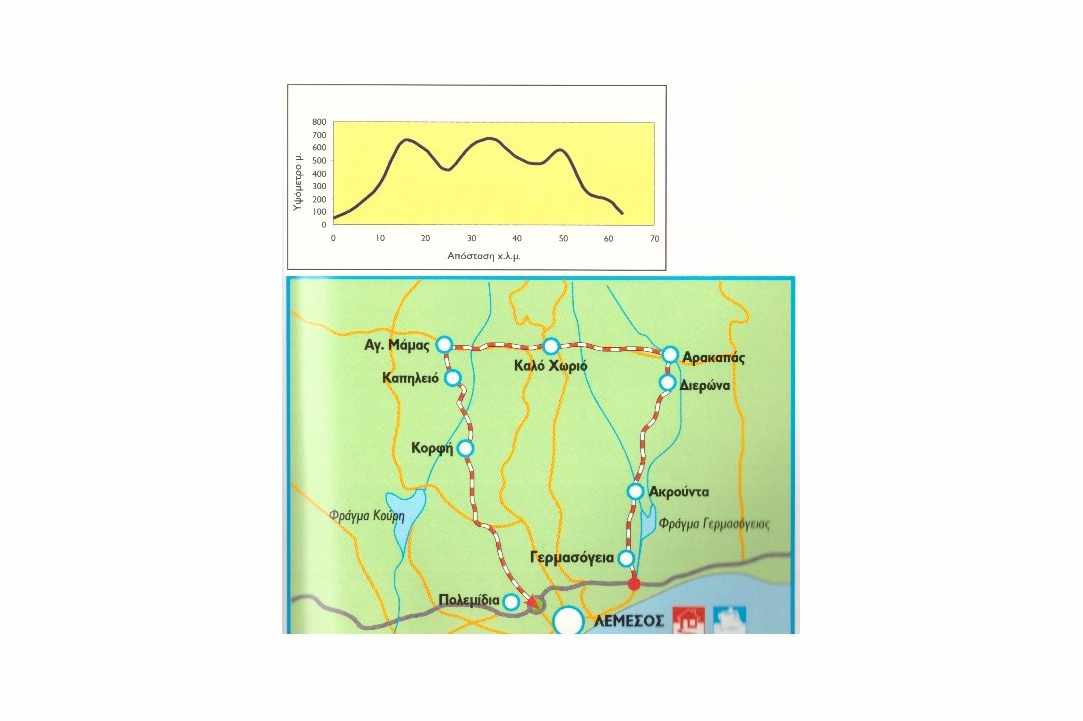
Germasoyia - Kalo Chorio - Polemidia
According to data provided by the Cyprus Tourism Organization (CTO), this route starts from the Municipality of Germasoyia and through the Water Dam of Germasoyia and the villages of Akrounta, Dierona, Arakapas, Kalo Chorio, Agios Mamas, Kapilio and Korfi, ends at Polemidia from a moderate difficulty, a distance of 63.5 kilometres in length and a current vertical of 840m, for which a 21-speed mountain bike is required, following a mixed surface asphalted road and a dirt road.
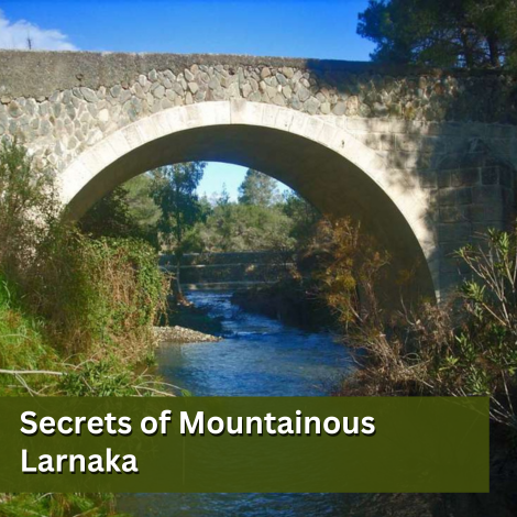
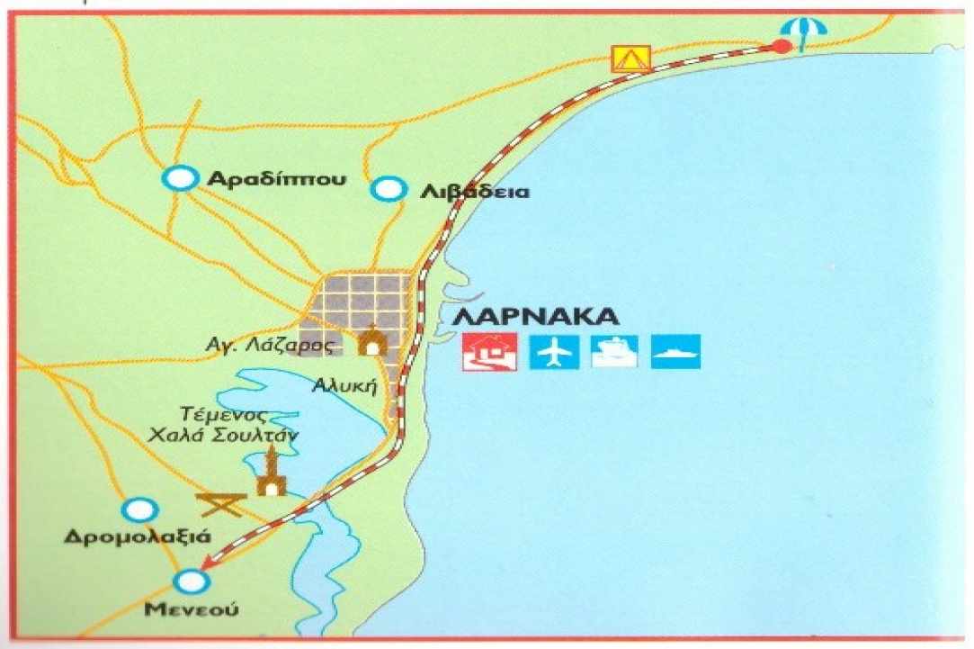
Tourist Area of Larnaka - Hala Sultan Mosque - Meneou
According to data provided by the CTO, this route starts from the tourist area of Larnaka and passing by the villages of Pyla, Voroklini, the Municipalities of Livadia and Larnaka, the Temenos Hala Sultan and the International Airport, arrives at the village of Meneou, of the newly established Municipality of Dromolaxia - Meneou, through a 18 km long, negligible current vertical height, easy for any type of bicycle, with an asphalt road along the entire length of the route. For the most fanatical of the species, the route continues alternately from the coastal road to the Ancient Kiti Tower, Pervolia and Kiti, to return to Meneou again.
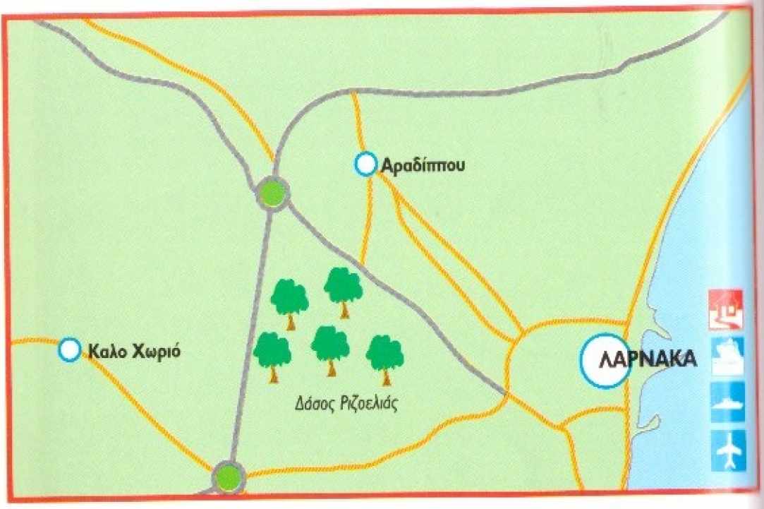
Rizoelia Forest
According to CTO data, this route starts from Eleftherias Avenue (main street of Larnaka - Aradippou) and moves on the Rizoelia hill, near which there are kiosks - restaurants, Forest Station, Police Station, and even a paintball field. It is characterised as an easy to moderate route, on a mixed surface, asphalt road and dirt road, requiring 21-speed climbing bicycle with front suspension. You can see a more detailed map here.
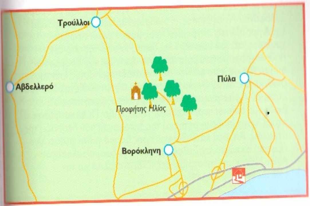
Voroklini Hill
According to data provided by the CTO, this route starts from the old village and goes up to two alternative routes to the park, which continues to the nearby village of Kellia or towards the chapel of Prophet Elias and the view point, while being part of the European Long Distance Trail E4. The route is characterised as a mixed difficulty, followed mainly by a dirt surface, whereby a 21-speed mountain bike is required with at least a front suspension. Near the road there are banks with ATMs, restaurants, pubs, kiosks, supermarkets, hotels, while going up the hill, the writer guarantees an unforgettable view of Dhekelia and the sea in the east, Oroklini and the sea in the centre and Larnaka, the sea and the district, up to Stavrovouni to the west, Kellia to the northwest and the village Troulli to the north. A more detailed map of the two alternative routes can be found here.
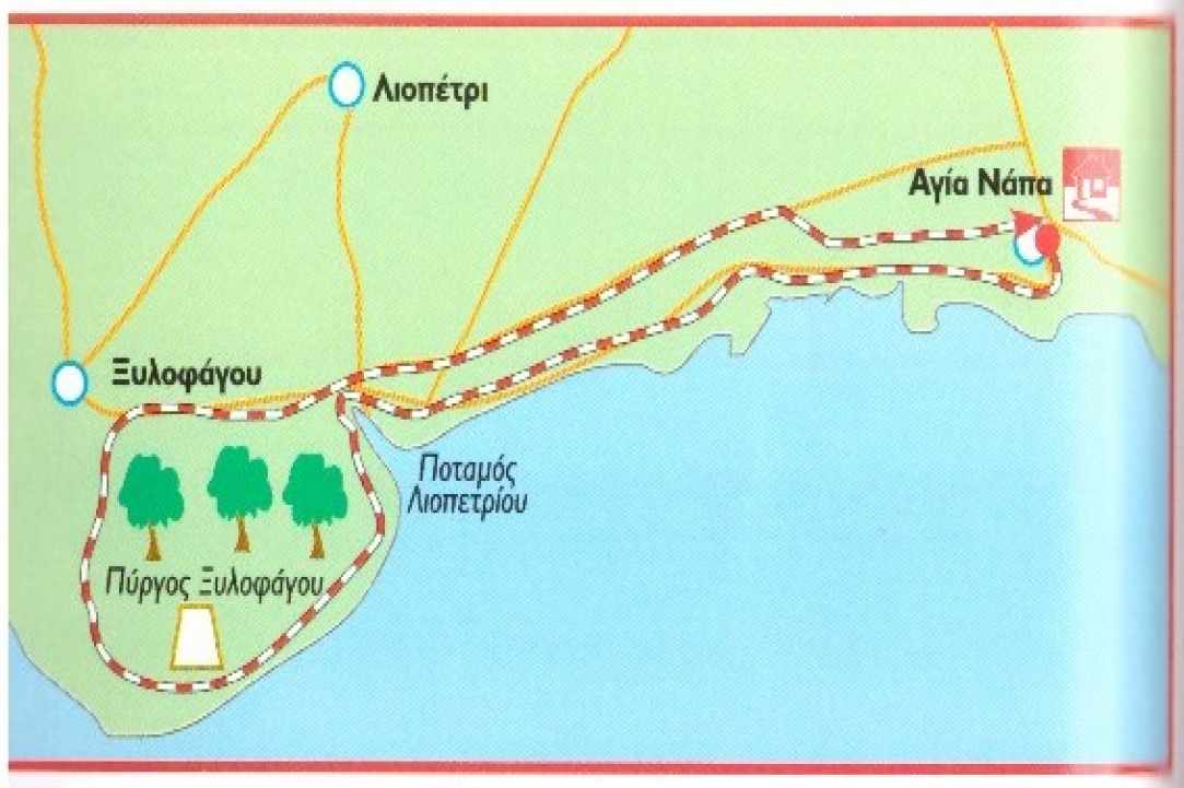
Ayia Napa - Xylophagou Tower - Ayia Napa
According to data provided by the CTO, this route starts from the Municipality of Ayia Napa and passes from the Liopetri River and the Xylofagou Tower is circular and returns to the Municipality of Ayia Napa. This particular route, which follows a mixed surface, asphalt road and dirt road, is characterised as easy, but it requires a 21-speed mountain bike.
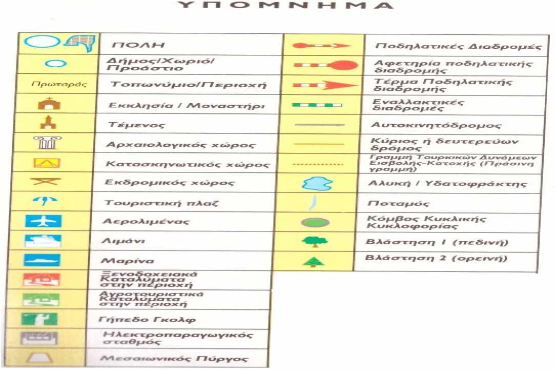
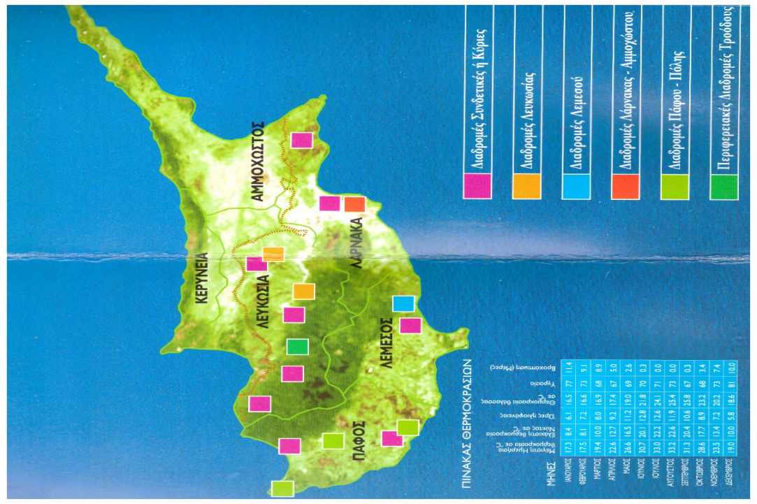
The copyrights of the maps belong to the Cyprus Tourism Organization
 Posted by
Anastasios Anastasiou
Posted by
Anastasios Anastasiou