English
 Ελληνικά
 Русский
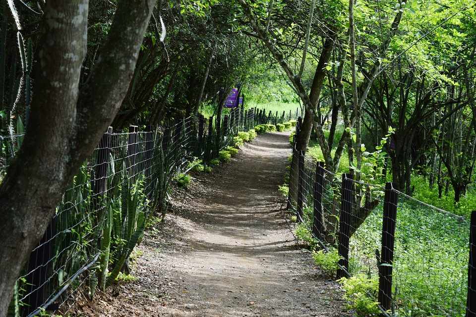
Bicycle routes of Cyprus
For real bicycle lovers - 5 of them in Troodos region
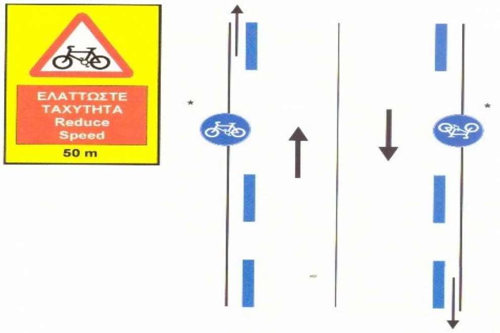
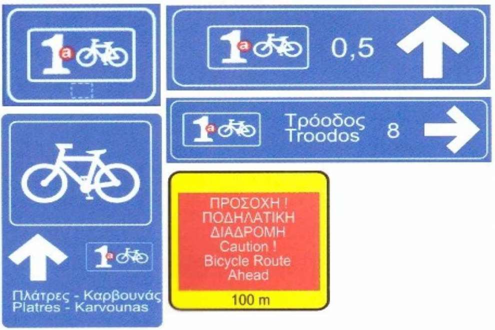
Cycling is a sport that can be done on an amateur level and requires only a few things: a bike in excellent working condition, water, a spare tire, a cyclist (trying to reach, at least) in good physical shape and a road or a path to grow. And like all the sports, it's something that you learn, you never give up. Something like a cyclist I confirm. And after seeing the general cycling information and rules in Cyprus, the time has come to look at various cycling routes as proposed by various competent bodies or by the writer.
Psilo Dendro - Karvounas: According to data provided by Cyprus Tourism Organization (CTO), this route is the first of three parts of a longer route, which takes place in Troodos. It starts from Pano Platres, at the site of Psilo Dedro, at an altitude of 1200 meters, and through a 16.2 km route ends at Karvounas, at an altitude of 1180 meters. It has a low degree of difficulty and in terms of road surface it concerns good quality asphalt and also a dirt forest road in good condition, depending on weather conditions of course.
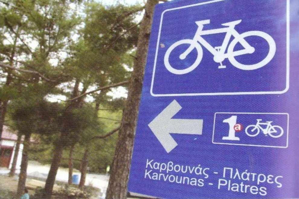
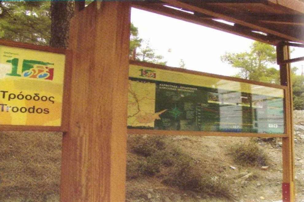
Karvounas - Prodromos: According to data provided by CTO, this route is the second of three parts of a longer route, which takes place in Troodos. It starts from Karvounas, at an altitude of 1180 meters, and leads through a 22.7 km route to Prodromos, the tallest village in Cyprus, at an altitude of 1380 meters. It has a moderate degree of difficulty and in terms of road surface it concerns good quality asphalt and also a dirt forest road in good condition, depending on the weather, of course.
Prodromos - Psilo Dendro: According to data provided by CTO, this route is the last of three parts of a longer route, which takes place in Troodos. It starts from Prodromos, the tallest village in Cyprus, at an altitude of 1382 meters, and through an 18.2 km route ends at Pano Platres, at the site of the Psilo Dendro, at an altitude of 1200 meters. It has a low degree of difficulty and in terms of road surface it concerns good quality asphalt and also a dirt forest road with sharp stones in some places, which requires special attention.
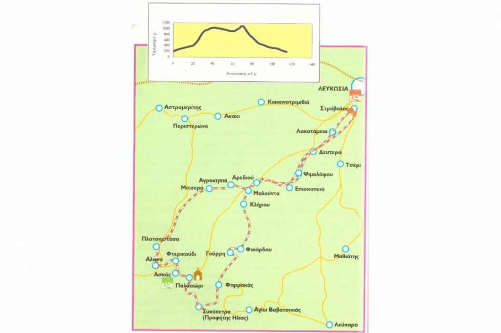
Nicosia - Pitsilia: According to data provided by CTO, this route starts from the interchange roundabout of Agios Mamas, passes from Deftera, Psimolofou, Episkopio, Arediou, Malounda, Klirou, Fikardou and Gourri vilages, where the alternative route divides the complete route in two and leads us to the asphalt paved road Pharmacas - Palaichori, where we turn right to return to Nicosia. The complete route from Gourri continues towards Lazanias, Farmakas, through a dirt road with cliffs view for adventure enthusiasts, while continuing to Prophet Elias on Sicopetra and then to Palaichori, Askas, Fterkoudi, Alona, Platanistasa, forest station "Gefiri tis Panayias", Mitsero, Agrokipia, where the return starts from the 2nd Nicosia Regional Secondary School, Arediou, Episkopi, Psimolofou and Deftera starts to finish, as well as the alternative route, to the Agios Mamas intercharge roundabout. The total distance of this route is 115 km, the current vertical height is 1265 meters, it is quite difficult, although after Alona it is only downhill and from the side of the pavement it concerns good quality asphalt and also a dirt forest road in good condition, and weather conditions of course, and a 21-speed climbing bike is required, where a suspension on the front wheel is recommended.
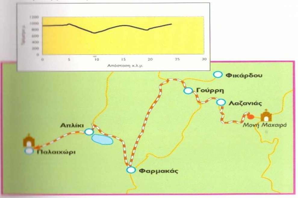
Macheras - Pitsilia: According to data provided by CTO, this route starts from the Machera's Monastery, and through a 25 km route through the villages of Gourri, Pharmacas and Apliki ends at Palaichori at a current vertical height of 240 meters. It has a medium degree difficulty as most of the route is on asphalt road, yet it contains some strong uphill and on the pavement side it concerns good quality asphalt.
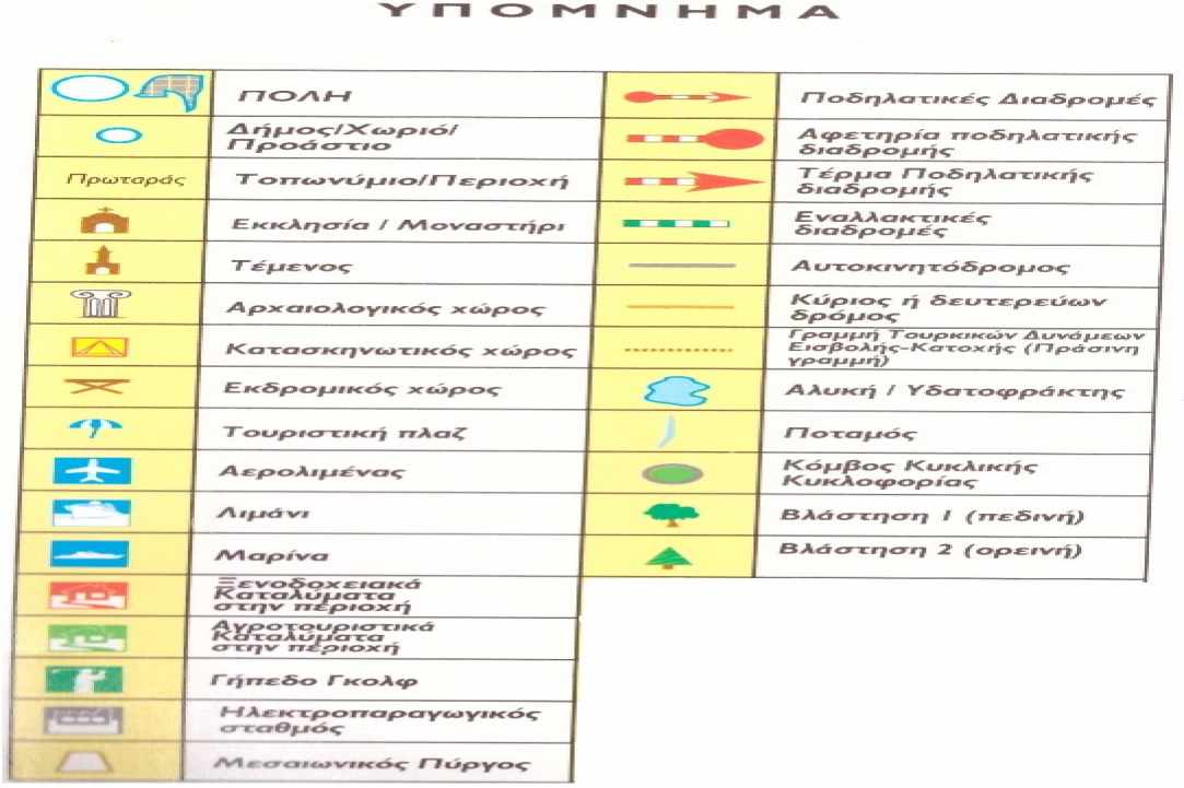
The copyright of the maps, the images and the graphics belongs to Cyprus Tourism Organisation.
 Posted by
Anastasios Anastasiou
Posted by
Anastasios Anastasiou